THE PICKSTONE FAMILY AND HERMANUS
January 13, 2021
Lemm’s Corner
January 13, 2021In the mid-19th century, the early inhabitants of Hermanuspietersfontein called it "Klipkop". It is an isolated hill rising some 75 metres above sea-level on the otherwise flat plain on which the town of Hermanus now lies. The origin of the name is fairly obvious to anyone looking at the Koppie. It comprises two parts: a sloping lower area, gradually descending to about 40 metres above sea-level, covered by luxuriant fynbos growth and dotted with huge rocks and stones. Above this area, sheer cliffs rise for several meters and are the origin of the name Klipkop. But today everyone knows the hill as "Hoy's Koppie".
The geological explanation for the existence of Hoy's Koppie is interesting. About 440 million years ago, massive rivers flowed across this portion of Gondwanaland. They were slow-moving and deposited silt in thick layers. Much later, when the rivers had ceased to flow, the silt hardened into shale. Volcanic activity pushed up the shale and formed mountains.
Harder rock was mixed into the silt deposits of the rivers and this also hardened and deformed under pressure. A column of harder rock was deposited at the point where the Koppie stands, which was then underwater. Wave action and currents wore away softer material but left the column of harder quarzitic sandstone standing. The area around the column was gradually worn away to a flat surface from which the column protrudes. Once the sea level had fallen, the column of stone stood alone on the flat plain cut by the waves.
However, the original name has stayed in use to refer to the only cave on the Koppie –so we have Klipkop Cave. It is interesting from a historical perspective, as it has been excavated twice and properly recorded. It is on the southern side of the Koppie, and is about 30m deep, 2m high and 25m wide, and is 100m above sea level now. The cave formed under the sea when sea-levels were much higher, but now is hundreds of meters inland. Various tests have dated it to the Middle Stone Age, about 300 000 to 25 000 years ago.
Later, the cave was used by San and Khoi peoples, and the much earlier remains were found several meters below the present surface.
A single human skeleton was unearthed, apparently buried in the cave. Otherwise, the material excavated consisted of a small number of animal remains (small buck, hippo, eland, tortoiseshell and an ostrich egg). Mainly, the cave was littered with thousands of shells of abalone and shellfish. Obviously, these were the main diet of the people living there, and they never put out the trash! One of the scientists remarked: "Maybe animals were scarce, or the cave-dwellers were just too lazy to hunt."
The cave has seen tough times since Hermanus was settled. For a while, two families lived there permanently, whitewashed the walls and generally left a mess. Then, graffiti writers defaced the walls. In the late 20th century, it became a favourite hiding place for schoolboys to drink beer and party.
Now, it Municipality keeps a sharp eye on the cave, at one stage even installing a motion-sensing device connected directly to the Law Enforcement division.
Klipkop Cave is well worth a visit when next you are walking on Hoy's Koppie.
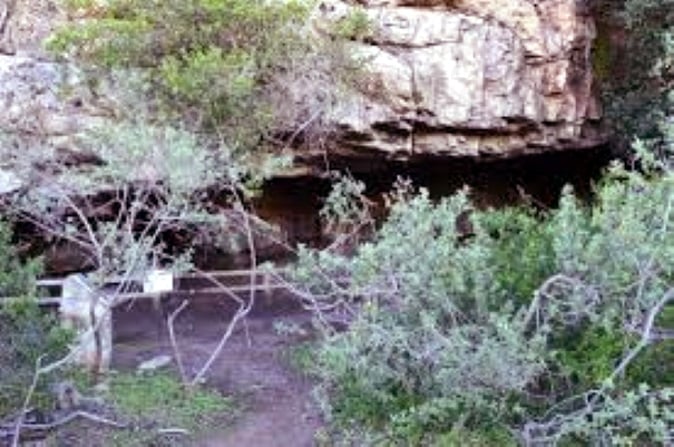
Entrance to Cave, partially hidden by fynbos
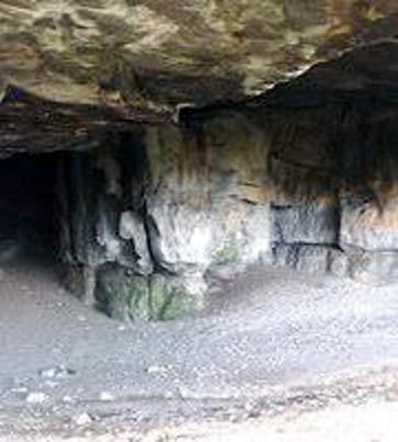
Interior of the cave. The interior wall built by modern cave-dwellers connected to the rock face centre of the photograph
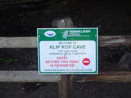
Signage at the cave. There is also a granite memorial stone erected by the Hermanus history Society
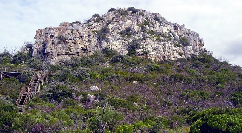
Hoy's Koppie, from the south. The cave is behind the cliffs on the far left
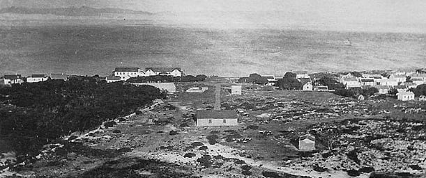
Looking south from Hoy's Koppie, 1920s

Looking south from Hoy's Koppie today
